N/A


Fellow Type: California Sea Grant State Fellow
Year(s) of Fellowship: 2020
Host Agency: San Francisco Bay Conservation and Development Commission (BCDC)
Sea-level rise is underway in San Francisco Bay – are we ready for it? Dozens of agencies, community groups, and non-profits are grappling with this question through the Bay Adapt initiative, facilitated by the San Francisco Bay Conservation and Development Commission (BCDC) and led by an advisory group of 30 executive-level Bay Area leaders. By 2050, water levels in the bay may be seven to 32 inches higher according to the 2018 State of California Sea Level Rise Guidance. Bay Adapt aims to develop a set of goals and actions to protect the region as a whole from this future flooding. But local management of the shoreline falls on the shoulders of the nine counties and more than 50 cities bordering the bay. Recent state legislation requires local jurisdictions to address sea-level rise in their general plans, which guide their future growth and development. How much sea-level rise planning has been done so far? This is an important piece of the puzzle – if we know where efforts are lagging around the shoreline, these areas can be targeted for assistance through the Bay Adapt program.
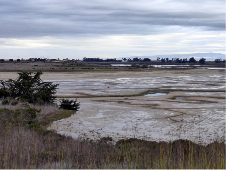
As a fellow on BCDC’s Adapting to Rising Tides team, I reviewed general plans to identify policies and programs aimed at reducing sea-level rise impacts. For example, which cities are planning to build levees, and how much tidal flooding can they withstand? Where is development prohibited in flood-prone areas? And, of particular interest to me, where will low-lying areas be restored to wetlands? San Francisco Bay has lost nearly 90% of its wetlands – valuable assets that protect inland areas from storm surge, provide critical nursery habitat for fish, and lock carbon belowground that would otherwise fuel climate change. Bay Adapt’s guiding principles echo state legislation in favoring nature-based shoreline protection wherever feasible. But where along the highly modified San Francisco Bay shoreline can marshes be restored? And what steps are required to establish healthy marsh at those locations? As a graduate student, I worked on a restoration effort in Monterey Bay that provides one model for how the process can unfold.
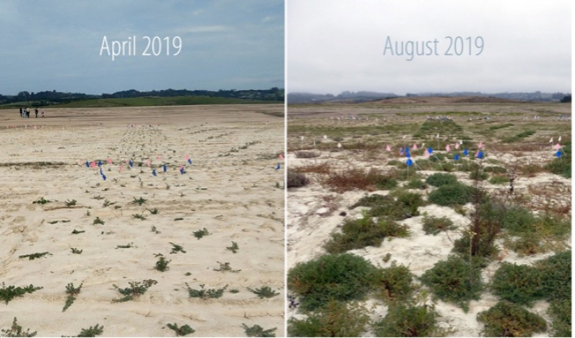
I joined the Hester Marsh project in Elkhorn Slough National Estuarine Research Reserve shortly before it broke ground in 2018. But the Elkhorn Slough Foundation was planning for sea-level rise for years before that, identifying the boundaries of the future flood plain and buying land from willing sellers in order to restore it. But restoring these wetlands isn’t as simple as just buying up the land—historic diking and draining of the marsh for agricultural use had caused much of this land to subside—or sink. Before subsided land can be restored to marsh, soil must be added to raise the elevation so that tides won’t drown salt marsh plants. Heavy equipment scraped soil from the hillside above Hester Marsh, adding about three feet to the marsh plain. The transition between the tidal zone and adjacent hillside was also graded to a gentle incline that will allow the salt marsh to migrate upslope as sea levels rise over the next 100 years. This work was funded by the California Department of Fish and Wildlife, the California State Coastal Conservancy, the California Department of Water Resources, the Wildlife Conservation Board, and the U.S. Fish and Wildlife Service.
As we look to the future of the San Francisco Bay, it’s clear that similar long-term planning and funding efforts will be needed to build and restore wetlands. It’s too soon to know what the San Francisco shoreline is going to look like next century, but I have hope that Bay Adapt will create the regional vision and collaborative partnerships necessary to restore and support natural communities along the shore for many years to come.
Related News
Apr 24, 2025
Apr 24, 2025